
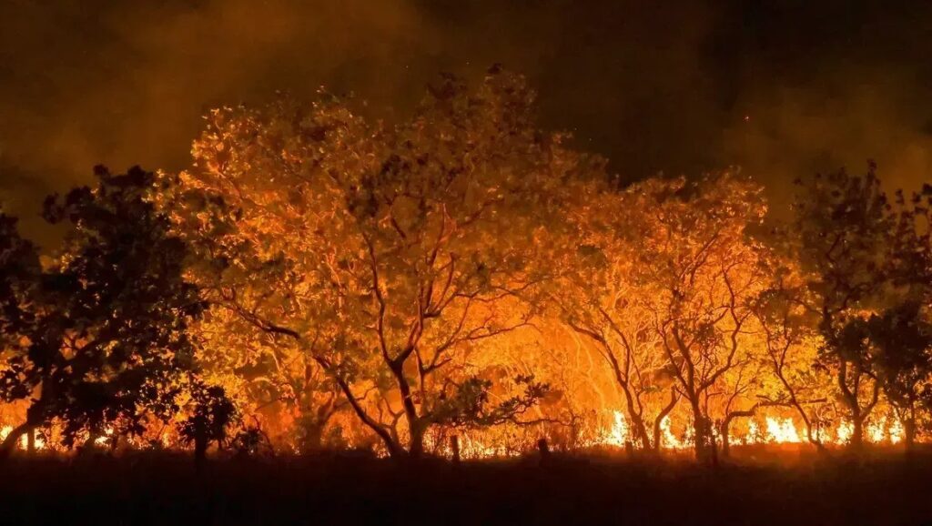
Brazil was a significant decrease in the area hit by the burning in the first three months of 2025. According to data from Fire monitoring, MapbiomasThe country registered 912.9 thousand hectares between January and Marchreduction 70 % compared to the same period from 2024When burns exceeded 3 million hectares.
Most of the burning space focused Amazon, responsible for 84 % of the total, with 774.5 thousand hectares affected. The state of Rourmia led the state rating, with a total of 415.7 thousand hectares in the quarter, followed by Para (208,600 hectares) and Maraho (123,800 hectares).
According to Felipe Martenexen, IPAM and MapiBiomas Fogo researcher, Roraima highlights his distinguished climate system. “While many Brazil lives in the rainy season, Roraima faces the drought season, which makes the country more vulnerable to burning during this periodHe indicates.
March 2025: historical fall, but it is warned in Cerrado
M March 2025It was recorded 106.6 thousand burnt hectaresWho represents the fall 86 % compared to the same month last year. A Amazônia accounted for 51 % of the affected areaCom Durged 55.1 thousand hectareswhile Cererado He was responsible for 37.8 thousand hectares.


Despite the general trend of reduction, Serardo is still a cause of concern. The day had an increase 12 % in the burned area in the quarter compared to 2024And I recorded March 80 % growth compared to the historical average From the month.
“This data enhances the importance of specific strategies to prevent fires and fighting strategies for each Brazilian dayVera Aruda, IPAM and Mapiomas Fogo, warns.
BIome data – from January to March 2025
- Amazon: 774 thousand burned hectares (72 % decreased)
- Cererado: 91.7 thousand burned hectares (12 % increase)
- Pantanal: 10.9 thousand hectares (86 % decrease)
- Atlantic Forest: 18.8 thousand hectares
- Katinga: 10,000 hectares (8 % decrease)
- Pamba: 6.6 thousand hectares (an increase of 1,487 %)
Continuous monitoring
Since 2019, and Fire monitoring It performs the monthly maps drawing of the burned areas in Brazil, using 10 meters satellite images. The platform allows the extent and location of the areas affected to almost monitor the actual time, as it is a strategic tool for environmental management and countering climate change.
All data, maps and reports are available to the public on Mapbiomas.
*Under supervision